Bay Area scenic-drive planning map
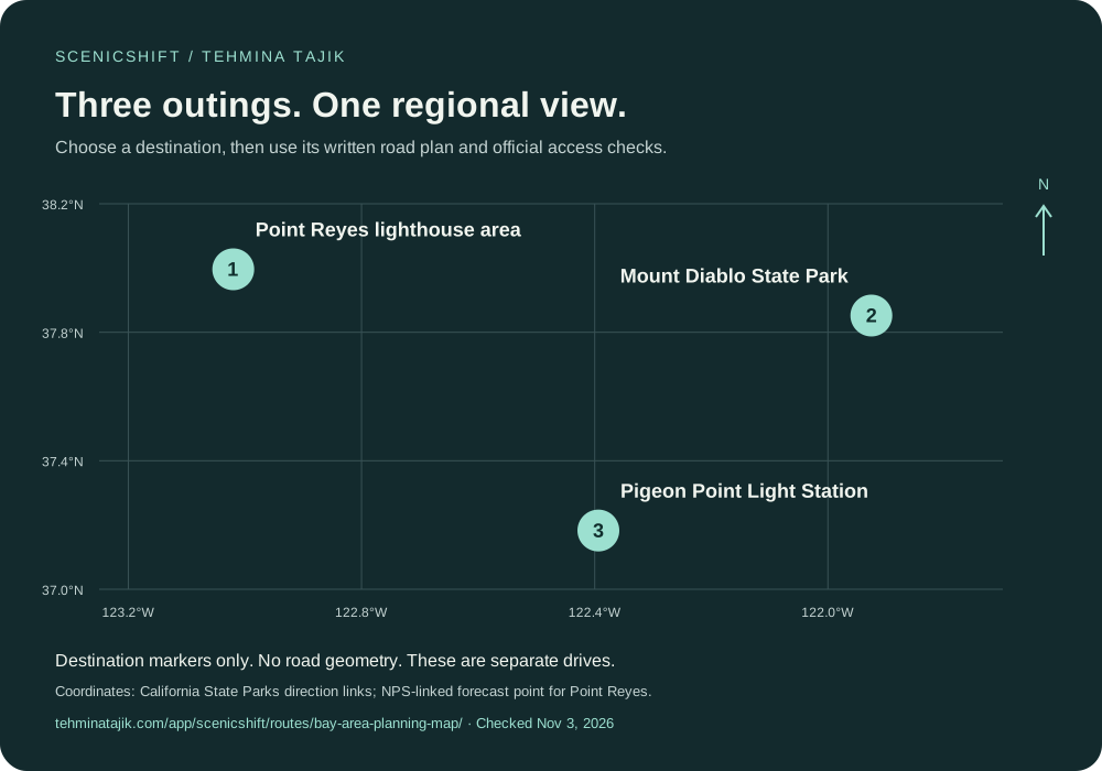
Choose a coastal headland, a mountain park or a lighthouse stop. This regional map places three researched outings in context, with a written road plan and official checks for each.
1. Point Reyes lighthouse area
Bear Valley / Olema to the lighthouse parking area via Sir Francis Drake Boulevard and Inverness. Return by the same road.
Allow about 45 minutes of driving each way, plus stops. Arrange fuel and food before the headlands; reception is limited. The lighthouse visit includes a walk beyond the parking area.
NPS-linked forecast area; approximate destination marker.
2. Mount Diablo State Park
From the Danville side, use Diablo Road and Mount Diablo Scenic Boulevard to South Gate Road, then Summit Road. Plan to return before the park closes.
This is a steep, winding park drive shared with cyclists. Use permitted parking and safe passing opportunities. Check gate hours, access restrictions and the visitor-center plan directly with the park.
Official park directions point; not the summit.
3. Pigeon Point Light Station
Follow California Highway 1 south from Half Moon Bay to Pigeon Point Road and the light-station day-use area. Return north on Highway 1 when the road is open.
State Parks places the destination about 20 miles south of Half Moon Bay. Allow extra time for fog, traffic and stops. Check park access and Highway 1 conditions; lighthouse restoration may affect what can be visited.
Official park directions point.
Share a useful plan
The three drives are separate outings. The map does not connect them into one itinerary.
Use the official links before departure and follow posted signs, closures and speed limits. Stop only in permitted places. Print or save the route information you need before losing reception.
You may print and share this unmodified resource free of charge. A source link is appreciated, not required. Sharing does not imply an endorsement or partnership.
How this resource was researched
Locations and access guidance were checked against NPS and California State Parks pages. The map is an original geographic locator using those agencies’ linked coordinates; it does not contain road geometry, live closures or first-hand driving observations.